We started our trip at Kingfisher Landing. Okefenokee Pastimes, in Folkston, shuttled us to Kingfisher and had us on the water by 8:30. Our day 1 destination was due north to Maul Hammock platform.
| We started out on a small lead of water, and it
never really widened. The channel was a long, lily pad obstructed, ribbon of water that
snaked across boggy meadows and through thickets of brush. It was
obvious the path had been pruned because we occasionally
passed big piles of snipped off brush that had been
pushed off to the side of the channel. I greatly appreciated that there were mile markers along the paddling trail. These reinforced that we were still on the trail and provided some sense of progress. Most of the paddling is through narrow avenues of water that split the surrounding bush, mostly swamp cyrilla. |
 |
| The scenery wasn't exactly the same the whole
way. We would occasionally paddle through areas that
resembled meadows, and sometimes through taller stands
of trees, but for the majority of the time, all we could
see was a wall of brush and the thin band of water ahead
of us. We paddled through a lot of weedy and lilly padded areas. It was surprising how much that slowed forward progress. At milepost six we rafted up and ate lunch in the boats. We never saw enough dry land to get out and eat lunch on shore. |
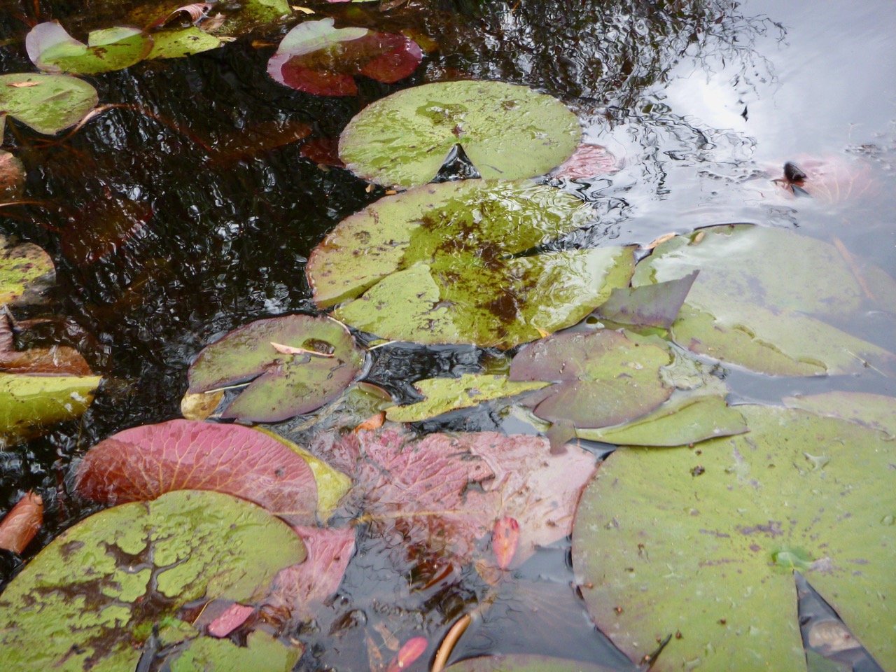 |
| There was a sign pointing off the water trail towards Maul Hammock platform. We paddled into the lead of water and found the camping platform on one edge of a large lily pad pond. It is said each platform has a resident alligator and we did see a medium size gator keeping an eye on us as we unloaded onto the platform. Later, night, flashlight scans of the surface revealed numerous pairs of eyes in the water.We had no raccoon/critter problems on the platforms. | 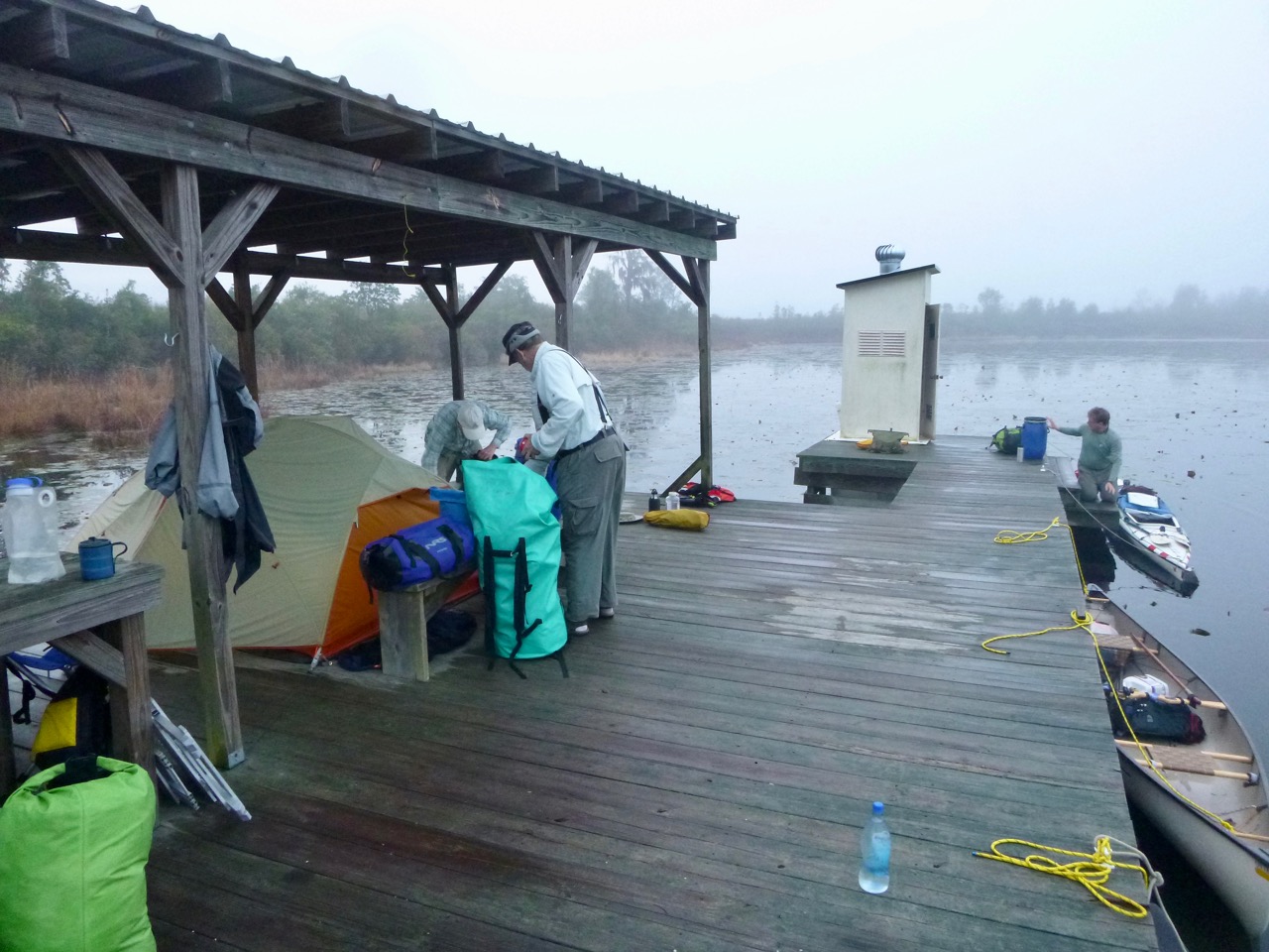 |
| Erecting
a tent on the platform was challenging and took Chip over
an hour. He'd brought along some tapered shakes with the
thought of using them to wedge in between planks in lieu
of tent pegs. Bill found the shakes useful in a few spots
but the section of platform where Chip put his tent had
very tight planks that he couldn't get anything to slide
between. On one corner of his tent, he ended up tying a
gallon bottle of water to the tent and dropping it over
the edge of the platform. That made a good anchor. It began raining as we set up our tents. We were glad to have the roofed section of the platform to use as a common area for food preparation and socializing. The rain continued off an on throughout the night. |
 |
| Thursday,
Jan 11, was overcast in the morning but cleared off to a
beautiful and warm day. We spent 5 hours paddling the
roughly ten miles between Maul Hammock and the Big Water
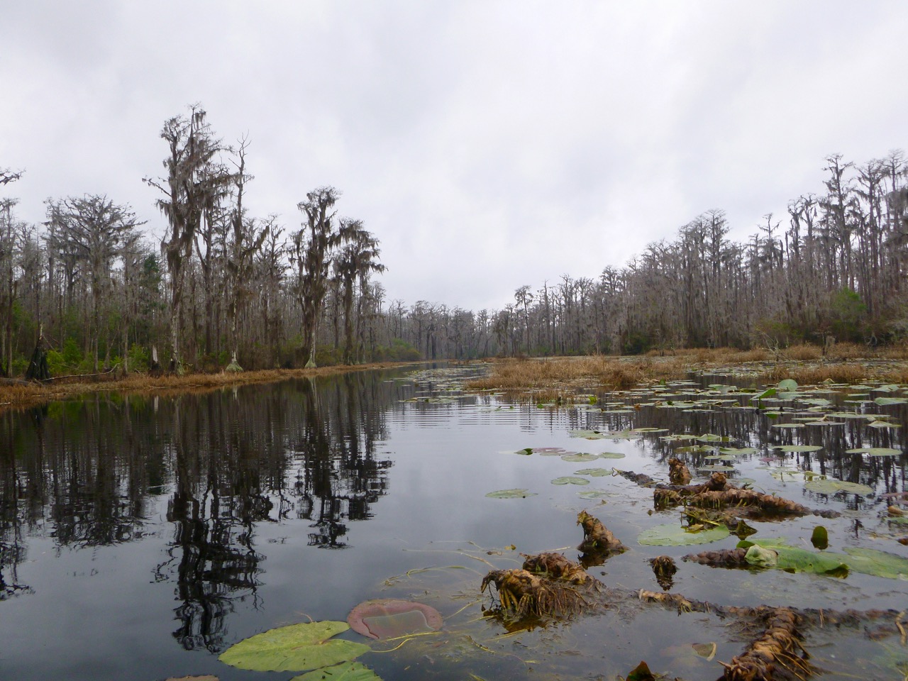
platform. This was a beautiful section. There were many large boggy meadows with grasses in the foreground and stands of trees in the far background. |
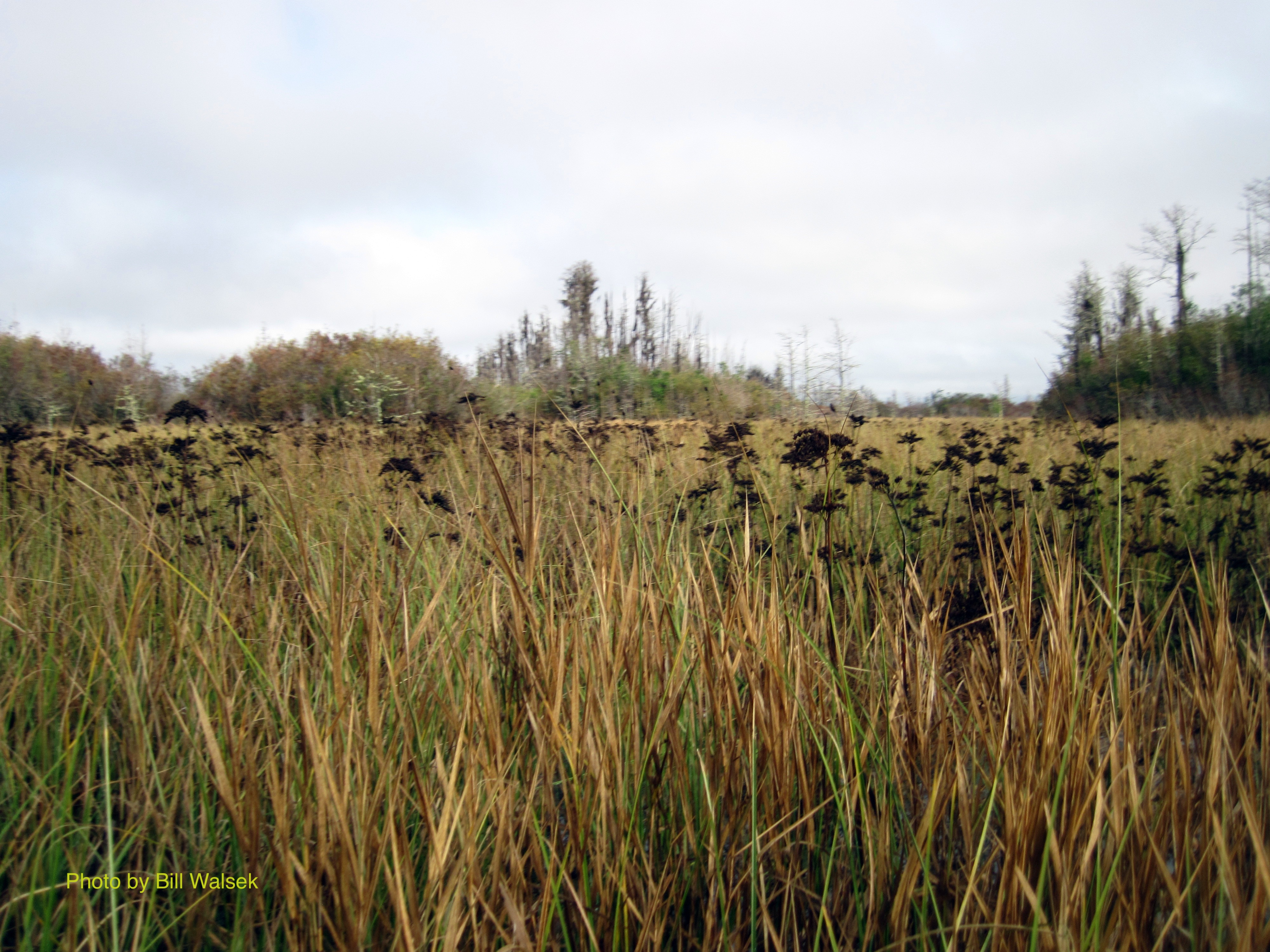 |
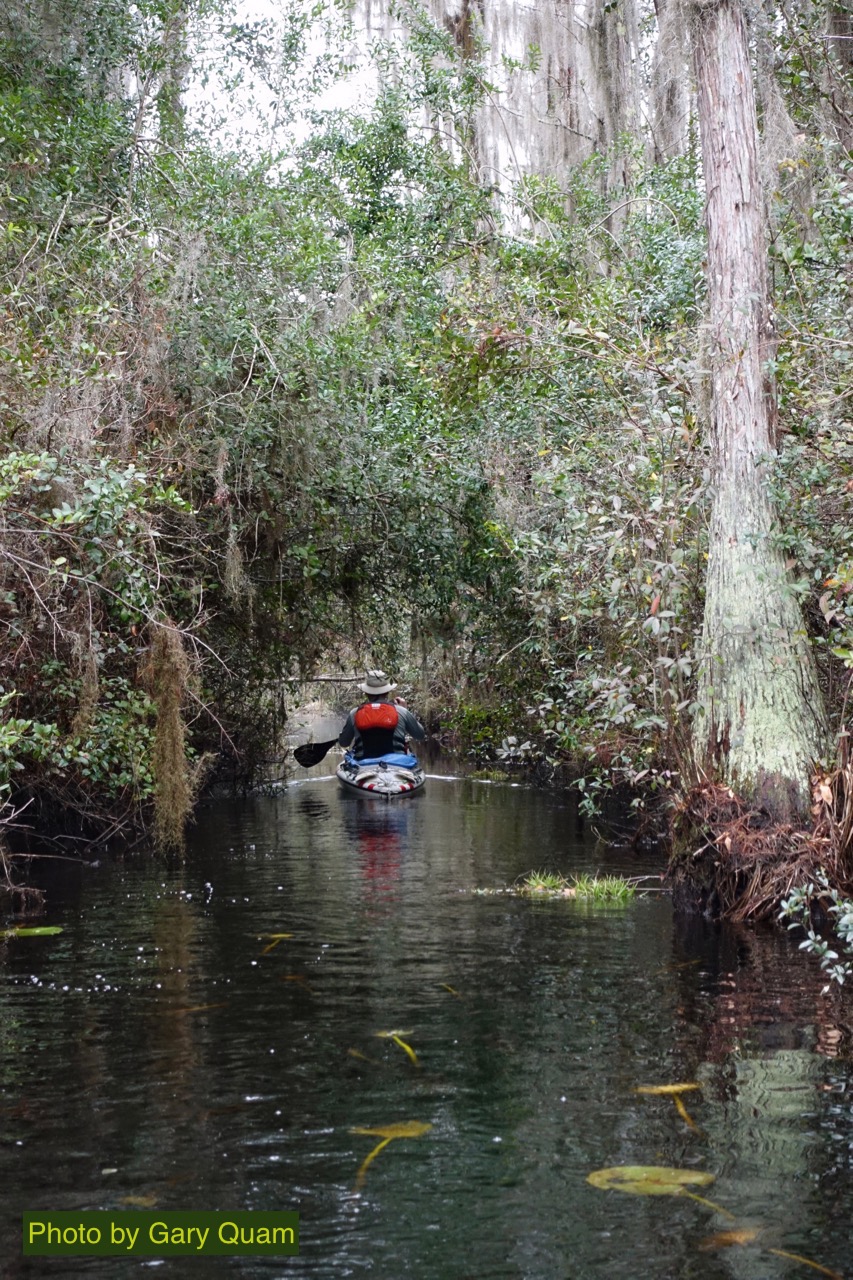
| The scenery varied between bush-shrouded channels to open grass lands were we began spotting sandhill cranes, to stands of hardwood and expanses of cypress forest. |  |
| The meadows were separated by thickets of either brush or cypress with a narrow channel of water connecting the two. An amazing feature of the Okefenokee trip was that 15 miles from our starting point, we were still paddling narrow, intimate bands of water. And it was obvious that the section of water between Maul Hammock and Big Water had not been pruned to nearly the extent of the channels we paddled on day one. My guess is, the NWR runs motorized boats out to service the platforms, but that these boats (and the pruning crews) do not run between Maul Hammock and Big Water. | 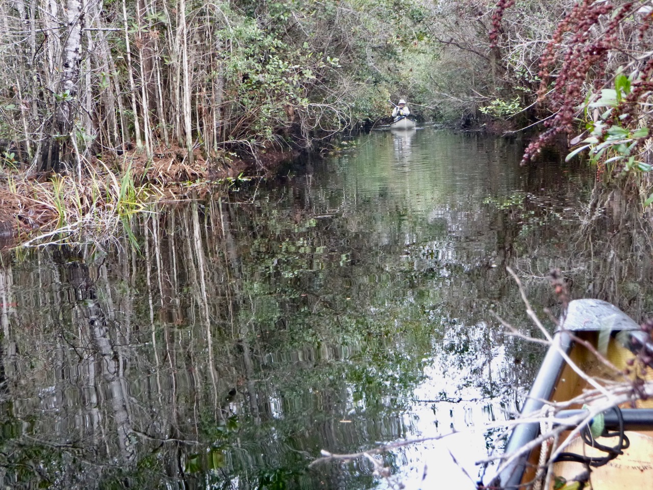 |
| >The day's paddling involved much branch dodging
and lop shear work. Bill and
Chip fell long behind the three Gs and feared they had
stumbled onto
the wrong river braid
and were getting lost. It didn't help that mile marker
17 was missing. They knew they'd been paddling for more
than a mile without seeing a marker, so they guessed
they were off trail. But, they bushwacked on, following the direction of water flow. Eventually they found mile marker 18 and, with
confidence restored, pushed on. At Big Water, the river
broadened into a long area 50
- 100 yards wide. Near the platform, several small
gators stood watch to welcome us. |
 |
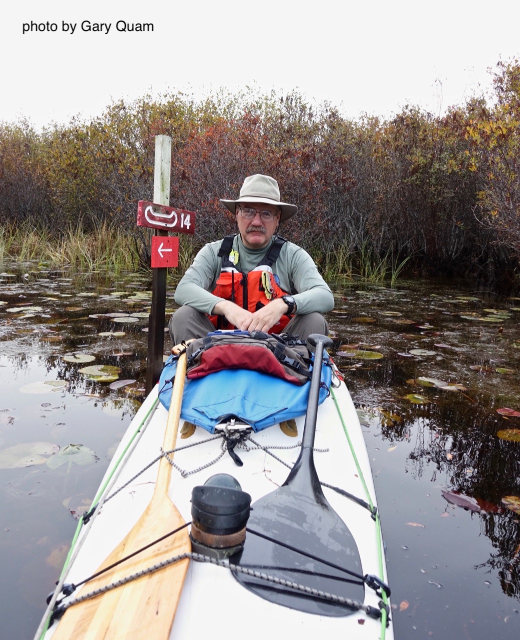
| Greg at a milepost,
waiting for the group to
catch up. |
 |
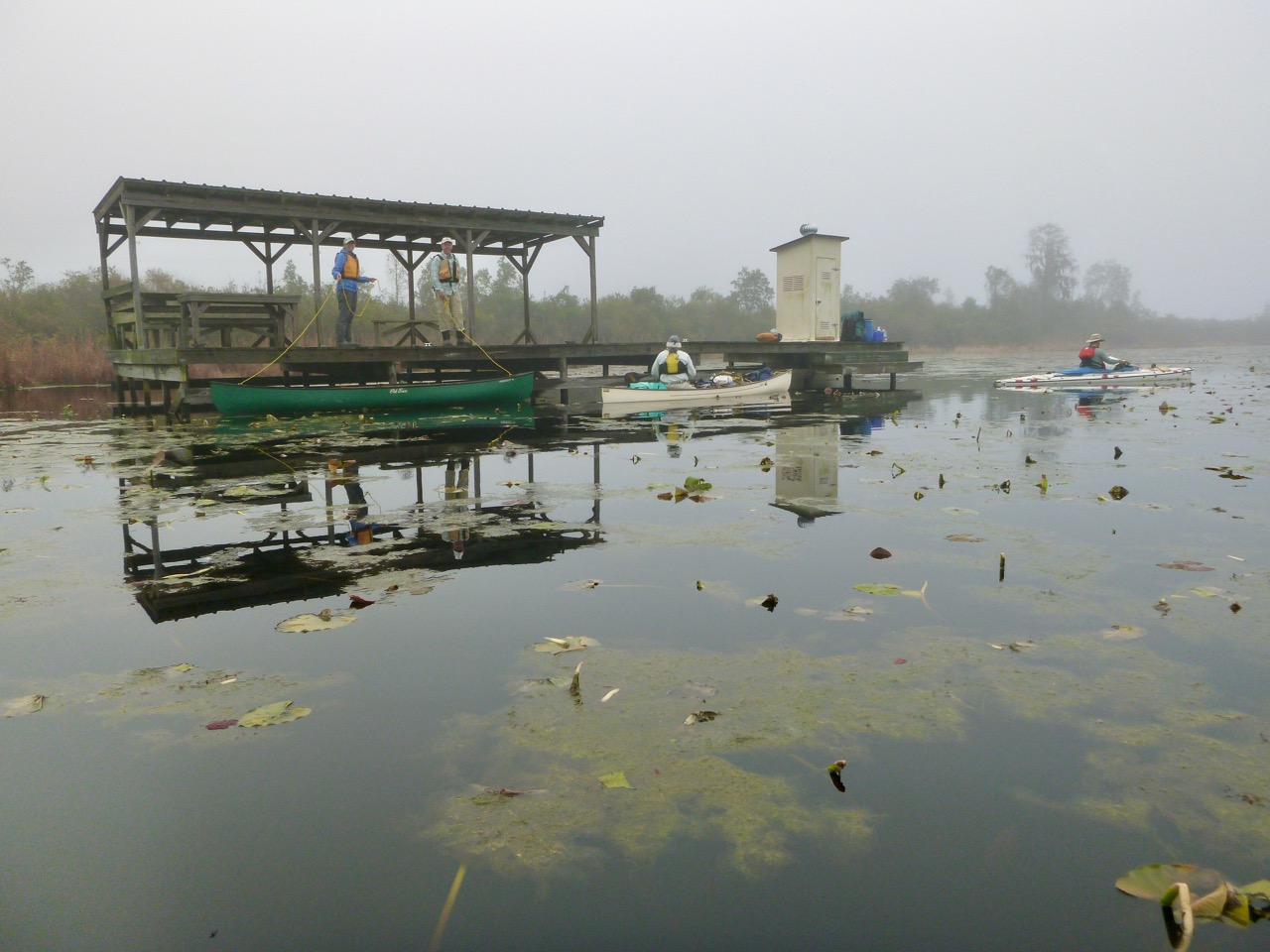
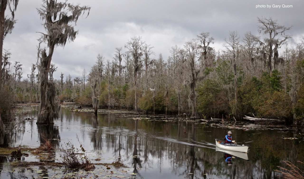
| Chip
approaching the Big Water platform. The weather had started out overcast and misty. By mid-day, it had brightened and the sun shined. By late afternoon, it was cloudy again, and once again, as Chip and Bill undertook the challenge of erecting tents on the platform, it began to rain. The rain continued off and on into the night. Sleeping quarters on the platform are tight. Greg commented on the noise of liquid disposal during the night. |
 |
| On
Friday, Jan 12, we had another day that started off soggy
and overcast, then turned sunny, before raining, again. Chip had to cut the trip short and set off early for an 11-mile paddle to Stephen C Foster State Park. Bill and the 3 Gs paddled 8.5 miles to Floyds Island Cabin. The Suwanee River originates in the Okefenokee, and by the time you get to Big Water, you're on the middle fork of the Suwanee River. While there were still some tight channels to be paddled, by and large the river was wider and less weedy than we'd previously seen. Bill likes to paddle a 280cm double blade. On the first two days of the trip, the waterways were too narrow for Bill to swing the 280, so he found these wider waters much to his liking. |
 |
| Maps of the water trails show two routes to
Floyds Island. None of us saw the first turn off. The
second turn off was well marked and led to a narrow
channel to Floyds, with lots of brush to dodge and cut. Having to return from
Floyds to the river by the same route gave the group
incentive to prune the trail, and Bill used the loppers.
The camp site at Floyds offered something the group hadn't seen for a few days: solid ground. There was also a cabin on Floyds that gave them room to set up tents on the two porches. The campers got everything set up and enjoyed the afternoon showers while sitting on the cabin's roof-covered porch. The sun broke out in the late afternoon and they capped the day off with a 2-3 hour fire from the small fire in a can. Bill used the small pot of paraffin. |
 |
| Chip didn't take the channel
to Floyds Island, but stuck to the River. The scenery
was excellent. The stands of very old cypress trees,
bearing their silver load of Spanish moss, were very
scenic. There was more animal life on the river, about
25 gators spotted, and probably many more undetected.
The river narrowed and widened a few times more on the
way in. In some stretches, the river braids and the
paddling is within the cypress forest. After clearing to
a blue sky, it became overcast and started to rain as
Chip came into the Billys Lake area. It started lightly,
but was steady raining by the time Chip made it back to
SCF SP at noon. He was pretty wet by the time the truck
was packed, but very happy with the whole trip. Big
Water to SCF SP featured some of the nicest paddling of
the trip. Not only is the scenery excellent, but the
river is more pleasant to paddle because there are few
weedy sections and the passages are more open. |
 |
| Approaching
SCF SP, the river widens in the Billys Lake section. |
 |
| This
is our track through the Okefenokee. Orange was day 1,
Purple was day 2, blue was Chip's track back to SCF SP on
day 3, while the others went to Floyds Island. Floyds Island is the light green blob in the center of the image, with the waypoint on it. I'm not sure where Greg found the way points, but I either input it wrong or the coordinates for the Big Water Platform were wrong. |
 |
| Temperatures dropped
after the rains of Friday night, and the group had a sunny but cold,
9.5-mile paddle out on Saturday morning. |
|
The shuttles worked well and SCF SP was a good spot to park vehicles. Okefenokee Pastimes: cabins and shuttle. Dale and Michelle run the place: 912-496-4472. The shuttles for our party of five cost $205 (very fair price) and the NWR permit was $235. The NWR fee made me wince but actually seems reasonable to me. They built and maintain the platforms and keep the trails open. If it wasn't for that, we would have never been able to see the Okefenokee and experience it the way we did. We had a fabulous trip. So, it was worth the price.
This was the first time Chip had been in a canoe for three consecutive days without setting foot on solid ground.
Last Edit 2/17/18.
All rights reserved.