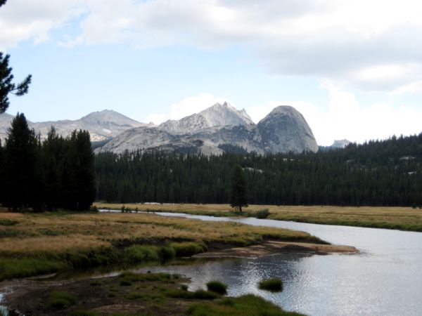
| I hiked along the meandering Tuolumne
River, and then the trail leaves the river and crosses bald
stone plates and domes. |
|
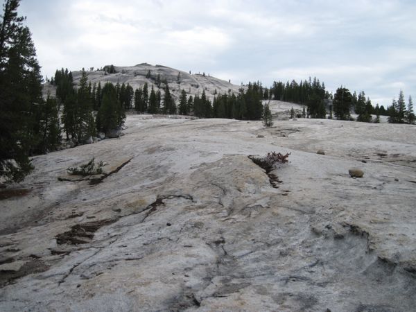
Afternoon thunderstorms are common in
these mountains. As I hiked, it clouded over and sprinkled
now and then, and I heard about 5 claps of thunder over
about an hour. The trail starts off mostly flat--some up and
down but no big elevation changes. But crossing the big
stone plates when I'd recently heard thunder, I felt very
exposed and picked up my pace.
As I approached Glen Aulin, the trail went over another set
of bridges, and I had arrived. |
 |
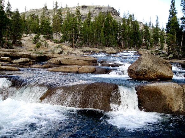
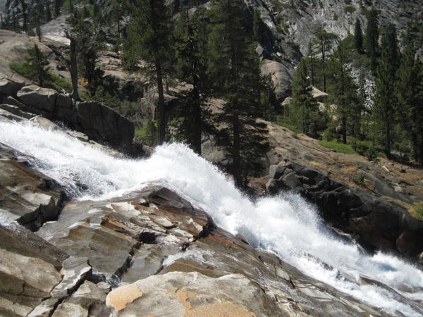
| The trail began to descend. The river was
on the left (south) side of the trail, but three or four
miles out the trail starts to drop and it crosses a bridge,
putting the river on my right. The river at this point is
dashing over rocks and tumbles down two picturesque falls. |
 |
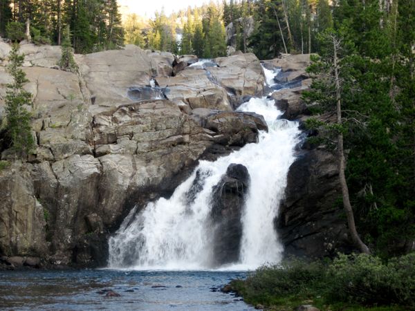
| As I approached Glen Aulin, the trail went
over another set of bridges across the River at a lovely
pool and falls, and I had arrived. |
 |
Glen Aulin was
confusing. I walked through an area where perhaps ten tents
were set up. Beyond that I found some bear lockers and a
privy, and there were a couple guys camped around a kind of
central clearing by the bear lockers. A trail led off to the
north, and off that were some more tent sites, mostly
unoccupied. There were supposed to be about thirty sites
here, and it wasn't clear to me what constituted a site. I
threw my gear down on a flat spot off the central clearing,
near the trail that exited north. The sites up the hill to
the north were bigger and nicer, but a long walk to the bear
lockers. All together, I think there were about 15 parties
camped at Glen Aulin that night.
I talked to one of the guys camped at the central clearing.
He was my age or older and was on the first night of a
ten-day trip and planned to cover something like 150 miles.
I was astonished, especially since he was attending to
bloody feet from blisters or something. I was wondering how
he was gonna pound out miles on bloody feet.
On Thursday morning, walked about and explored the area a
little more. I had missed the High Sierra camp when I came
in. High Sierra operates a number of back country camps,
equipped with semi-permanent tents on platforms, a kitchen
and dining operation, and showers and flush toilet for
guests. The sites are spaced about a day's hike apart. So,
in theory, you can hike from one High Sierra camp to
another, carry only a minimum of personal gear, and have
your meals cooked for you. I chatted with Ed and Linda
from Atascadero, Ca. The previous day they had done the hike
down the Tuolumne Valley and recommended it, so that became
my plan for the day.
|
| Initially, I was confused where to pick up
the valley trail, but a nice woman named Jackie pointed out
the way. Jackie and I were both headed to Waterwheel Falls,
and we would leap frog each other on the trail all morning,
as one or the other of us would wander off the trail to snap
pictures. It was a beautiful day, the sun was lighting up
the mountains, and every time I looked up it seemed like a
picture begging to be taken. The pools and drops of the
Tuolumne were very scenic and the whole valley was sweeping
rock domes and sheer granite cliffs. |
 |
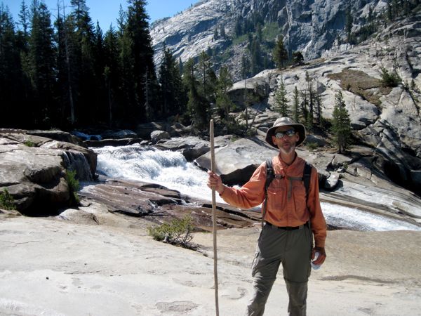
At one of our crossings on the trail,
Jackie and I swapped cameras and took each other's picture.
|
 |
| The trail was rocky, went up, and mostly
went down. I paid close attention to where I put my feet--it
would be easy, and painful to trip. Around noon I reached
what I thought was Waterwheel. The trail continued down the
valley and appeared to drop a couple hundred feet from where
I was standing. Looking down the trail, thinking about the
return trip, I decided if I wasn't at Waterwheel, I didn't
really want to see it that bad. That's when Jackie caught up
to me and asked "is this it?" I explained my reasoning and
she agreed. We sat down on a rock face and had lunch
together with our legs dangling over. It had gotten hot, and
one thing we talked about was finding a swimming hole on the
way back. She finished lunch before me (I was eating a very
hard bagel from BWI that took me a long time to chew) and
headed back, and I told her to find a good swimming spot. |
 |
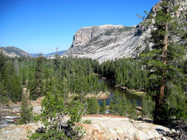
At our lunch spot, when we looked up from
the river the view we had is shown at right.
|
 |
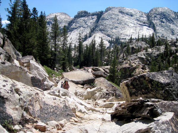
At right is an image of an unknown hiker
who passed while I was walking back to Glen Aulin. This
picture is included because it shows the ruggedness of the
trail.
|
 |