WAKE Trip to Kyoquot Sound
Vancouver Island, BC


July 27 - Aug 3, 2012

Paddlers
Dave Peeble - TL, Fishermen, and Cook in a Pygmy Coho
Frank Wilson- Pygmy Coho
Les Hibbert - sea kayak unknown
Dawn Gross - Impex Currituck
Lori Stetter - Wilderness Systems Tempest
Chip Walsh - Azul Sultan

Getting To Kyoquot Sound

The group rendezvoused in the vehicle que of the ferry terminal at Twassen, BC. We caught the 7:45 a.m. ferry bound for Nanaimo. The crossing took about two hours, during which time we got acquainted. Several of the paddlers knew each other previously while others had not met. This was an easy-going group and since I had never met any of them, I really appreciated their effort to make me feel welcome. When we off loaded in Nanaimo, Lori climbed in the truck with me for the ride to Campbell River. It was nice having a passenger to chat with after driving 3,000 miles from Maryland by myself! It made the 100-mile drive to Cambell River seem short. The signing, with distances expressed in kilometers, also made the drive seem to go by quickly. Signs indicated Campbell River was a 147 K drive. That seemed a little deflating, but those K's flew by.

The first stop in Campbell River (population 31,186) was for lunch at the waterfront Quay West restaurant. We sat outside and enjoyed views of the Straight of Georga and Quadra Island. Lunch was good, but we had more stops to make: we hit the Real Canadian store for fresh produce that we were not allowed to carry into Canada, topped off our gas tanks with pricey fuel (by the liter), Dawn hit the Starbucks, and Dave went over to a Tire place to get a fishing license. We regrouped and headed for Zeballos, this time with Dawn as my passenger.

The first 93 miles from Campbell River are over dual-lane Route 19. The scenery became increasingly scenic with verdant evergreen forests lining steep mountains, often with snow deposits in the heights. We stopped for views of Johnstone Straight, where there was a neat display about the efforts made to remove Ripple Rock, which had caused 119 ship wrecks. After 93 miles, we turned off Route 19 onto unpaved road. We stopped to admire a very steep mountainside that had ribbons of water cascading down its face. Our convoy increased the space between vehicles so that we were not driving in each others' dust clouds. Reach Zeballos (population 130), we wheeled into a campground where the group filled up containers of water. Then it was quickly back into the trucks for another 20 miles or so to Fair Harbour, our launching point. The road between Zeballos and Fair Harbour were rougher, but we made it without incident.

At Fair Harbour, we pulled into another campground. It was already about 6 p.m. We'd been travelling for 12 hours! It had begun to mist as we approached Fair Harbour, and that weather stayed with us through the next day. Surprisingly, a helo landing pad had been spray painted in bright orange on the widest opening in the woods, where we first thought to camp. We moved back to site 22 when informed a helicopter was supposed to land on the orange "H" at 5 a.m. the next morning. Les and I slept in our trucks, and our other four paddlers set up camp.  The campground was socked in by fog and mist in the morning, and the helo didn't arrive until well after we departed. We paid $20 to camp, and Les and I would end up paying $36 for parking our trucks at Fair Harbour while we were paddling. Cagey Dave found a free parking space.

Fair Harbor to Rugged Point

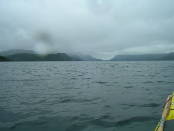
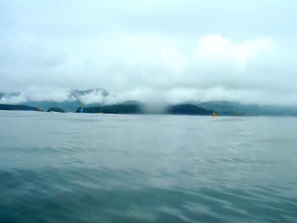
We launched about 9:30. There was a moderate headwind as we exited Fair Harbour. We hugged the Markale Penninsula and crossed Pinnace Channel to take advantage of the lee of Hohoae Island for a mile or two. Misty Kyoquot


The paddling was different for me. The water was clear, cool (I think around 60) and from several hundred to a thousand feet deep. The banks were lined with large rocks covered with acquatic plants, muscles, barnacles, and starfish. starfish
Above the banks, the rocks gave way to verdant green. Mostly evergreens lined the slopes that angled steeply up from the banks. The slopes ascended into a layer of clouds that seemed only a few hundred feet above the water. Misty Kyoquot
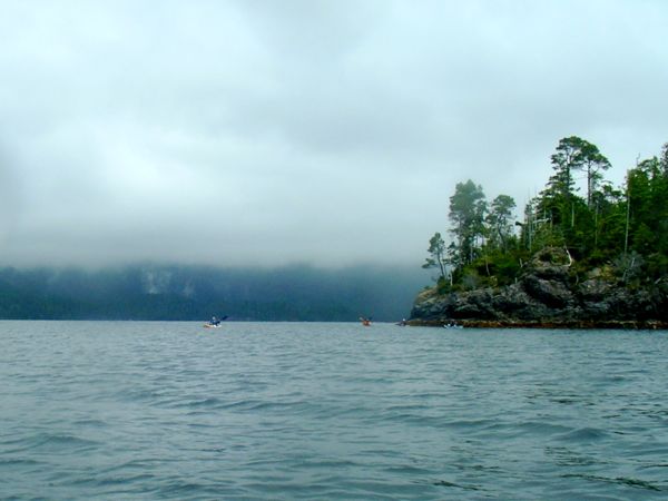
Our gear-laden boats sliced through a foot of wind chop and we paddled toward and around Whiteley Island. Dave guided us to a little beach on the south side of Whiteley and we stopped there to stretch and eat lunch. We could see our destination, Rugged Point from our lunch stop, perhaps 3 - 4 miles across Kyoquot Channel. After lunch, able to see our destination, we all felt better that most of the paddling work of the day was done and we veered south to hug the southeast coast of Kyoquot Channel and enjoy the scenery. Conditions improved as we neared Rugged Point and landed on the sandy beach overlooking Kyoquot Channel. Misty Kyoquot
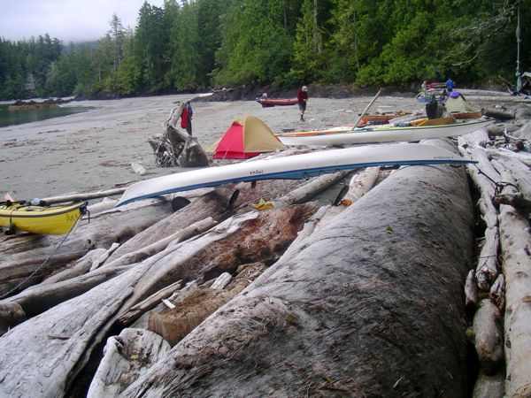
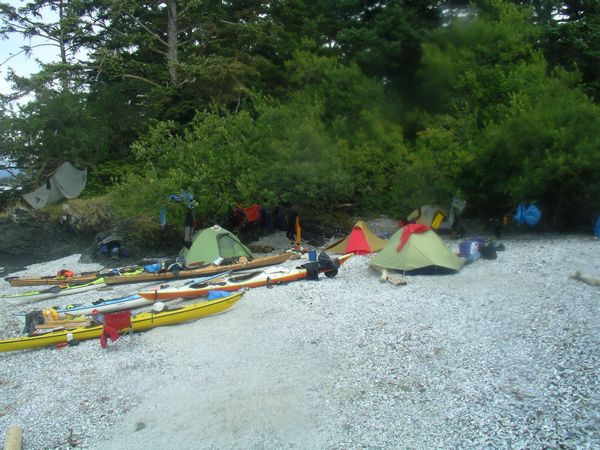
Half our party disappeared into the forest at Rugged Point. They followed a path through the forest and crossed to the beach on the ocean-side of Rugged Point and evaluated camping options--sound side or ocean side? Sound side was selected, and we proceeded to unpack boats and set up camp. There was a large collection of silver-weathered timbers at the storm surge line. Dawn, Dave, and Frank set their tents on bare spots amid the logs. Lori and Les found tent-size openings just on the edge of the woods. I set up on a tent platform cut into the woods a short distance away. There was another party camped just to our south--a family with kids age 8 and 3. They'd arrived via an outboard-powered inflatable. A second family socialized with them but retreated to a power boat anchored off the beach at nightfall. camp on loggy
              Rugged Point (sound side)


An unexpected luxury at Rugged Point was a pavilion-covered table and steel bear-lockers.

With the exception of Dave, each of our group where on individual kitchen and dining plans. So, we all had our own kitchen gear and individually cooked our meals. Often we cooked at about the same time, so we were more or less eating together, but differently. Les and Lori seemed to favor the foil-packed camp meals. Frank used some canned goods. Dawn was forever consuming some kind of liquid that came in 8 oz boxes. Quite a bit of wine was packed along, I'm not sure by who. Dave was often cooking real food, and on two occasions cooked group meals. Frank cooked a pot of muffin mix each night, refining his cooking technique over the course of the trip. The group got to sample the muffins the next morning. I got to looking forward to the daily muffin!

View of the beach and Sound on the north facing, interior beach at Rugged Point. The mountains about a mile and half across the sound are on Union Island, which is miles long and wide.
Beach at Kyoqout
              Sound
On the Pacific side of Rugged Point, there is a lovely beach. The group decided not to camp on this beach in case the surf came up during our stay. It might be hard to launch into boisterous surf.

The ocean-side beach at Rugged Point was interupted on either end and in the middle by rocky outcroppings. Others pointed out bear and wolf tracks on the beach. Lori spotted a whale spout and she, Les and I watched as the whale continued a south to north course that brought him in front of the beach, about a half mile out. The whale was swimming and surfacing with regularity and Les would predict where it would next surface.
Pacific Beach at
              Rugged Point
Patterns in the sand, Ocean side, Rugged Point Provincial Park
Rippled beach at
              Rugged Point, Pacific Side


Day trip to Grassy Island

Grassy Island is an island that sits about a mile out in the Pacific, several miles southwest of Rugged Point. There is a reef-like series of rocks and islands along the coast there. The water between the island reef and "mainland" Vancouver Island is labeled in the chart as Clear Passage. So we rounded Rugged Point and paddled southeast in Clear Passage against a 10-15 mph wind. The weather radio cited the sea swell as .75 meters, and there were wind waves on top of those of a foot or so. I was enchanted by the feel of the ocean swell and the site of my fellow paddlers gently rising and falling amid the 
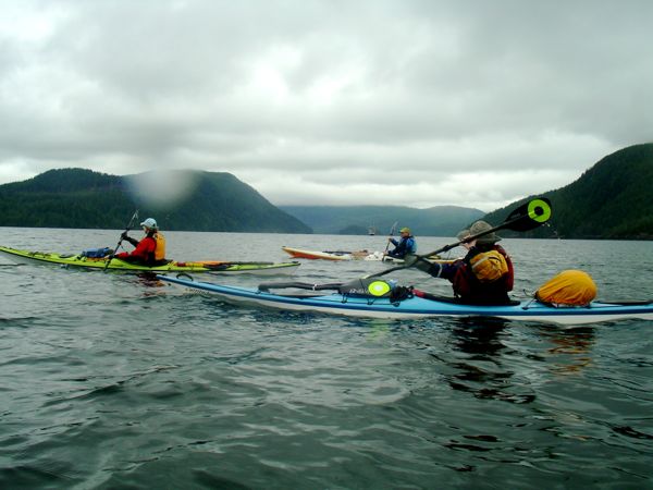
swells.

We passed a rocky feature the map labeled Nipple Rock. I took some pictures of the group passing Nipple Rock, more fascinated, I think, by the name than the rocks.
Nipple rock with
              kayakers
Grassy Island was a big enough rock outcropping to have trees and grasses sprouting up where soil had accumulated among the craggy rocks. A guide book stated that the Grassy Island had never been glaciated, like elsewhere on Vancouver Island, and therefor had unique fauna. On first arrival, we all broke out lunches, sat on a log, and ate. Initially, I was not much impressed with Grassy Island. Misty Kyoquot
But after lunch, nature called and I wondered off to find a secluded nitch in the rocks. I was amazed to find a number of leafy and flowery plants growing from obscure little cracks in the rocks. flowers in the
              cracks
I so wish the camera work was better.
Additionally, the rocks themselves were metamorphic layers and, on close examination, I could see many fossils in the rock.

A pretty niche among the rocks at Grassy Island.
Rock on Grassy
              Knoll
Walking among the tidal pools, I saw anemonie and shrimps darting about. Grassy Island had a raw, intoxicating beauty that took me by surprise as we lingered. Dave, meanwhile, had set up off shore to fish. We finally got worried we were going to be trapped by the reciding tide and launched our boats. I puttered south a bit while waiting for others to launch and saw a sea lion colony on nearby rocks. Tidal pool


On the return trip from Grassy Island, I was looking forward to the trailing wind and swell we earlier had in our face. The wind and swell had grown a little, and Dawn didn't care for the way it shoved her kayak around, so we headed north and got to the land's edge of Clear Passage. The paddling by shore was less exciting but more interesting, and we paddled through small gaps in the rock strewn stretches along the coast. From a distance, it would look like a solid line of rock, but as we'd get close we would find gaps, and sometimes could paddle through.

Dave dropped off as we rounded Rugged Point. He tied off to some Kelp and proceeded to catch at least a half dozen fish: ling cod, black cod and rock cod. When he came back to camp he proceeded to fillet the fish in preparation for a fish fry.

Lori, Les and Frank continued past our camp and went to find fresh water to replenish their water supply. As they were gathering water they encountered two bear cubs. Then they heard momma bear descending a nearby tree. They aborted water gathering and returned to their boats, thus ending the only bear encounter of our trip.

The day's weather had followed the pattern of our first day. It started off misty and overcast. In the afternoon the mist lifts and we even got a few rays of sun. By evening, we could see mountain tops. On this evening, a number of whales began to forage in the Sound in front of our beach. The sound at this point is about a mile and a half wide, and you can see for several miles in each direction. All evening long, we would see the tell-tale spouts of whales surfacing, followed by the black form of their backs along the surface. Spouts would sometimes appear almost at the same time and far enough from each other that we knew we were seeing some number of whales. But, they don't hold still for counting and it isn't possible to say how many were swimming in the Sound in front of us. I was enthralled by the knowledge these magnificent behomeths were sharing the same waters we were kayaking.

Rugged Point to Spring Island

It rained overnight and was only letting up about the time we were packing out of Rugged Point. Les and I carried our boats nearly down to the water and proceeded to pack. I was amazed how quickly the incoming tide overtook the spot where I was packing my boat. I had to drag it back at least five times, each time the boat a little heavier. On this trip, I thought I had packed a rather minimal amount, but I had a heck of a time getting everything in. We launched about 9:30.

Today's route was due northwest. The winds were minimal. It was rain/misting intermittently, but we had good visibility and could see Thorton Island, a mid-point along the Spring Island vector. We paddled past the 30' rock cliffs of Union Island (that's a big honking island!) and into the Pacific. The roughly 4-mile, open-water crossing went smoothly and we soon were landing on Thorton. A previous camper spent considerable effort setting up a kitchen in a nook in the rocks. The "kitchen-window" was a touch that made me laugh. We ate lunch and listened to the weather radio. Since it sounded like the winds were going to behave, we decided to continue the open-water crossing. The sun came out and it turned into a stellar afternoon. The clouds even lifted off the mountains and we could see the snow-covered mountains behind the coastal mountains.

We made more sea otter and whale sightings on the crossing to Spring Island. The swells were a little larger than yesterday's, and there were almost no wind waves. Again, I was enchanted by paddling on the Pacific. I felt very lucky to be there.

At Spring Island we found a group of eighteen paddlers from Seattle camped on a tombolo near the end of the island. To me, the tombolo looked like the largest and best place to pitch a camp. But Dave was pleased the other party had left a small, shell beach empty. That was the spot he liked to camp because it has superior wind protection, and that was where we set up camp. Several of us initiated small grading projects to smooth and flatten the broken-shell beach to make spaces for our tents. Frank's site even had a little retaining wall. I was concerned about putting my tent on the shell beach, because with the sharp broken shells, I figured it was going to be the end of the tent floor. Hopefully, the smoothing job limited the damage. That morning, we'd packed up a lot of stuff in the wet, and after unpacking, our site had that "yard-sale" look as everybody tried to dry out their gear in the afternoon sun.

There were fishermen among the Seattle group. Towards evening we saw them carrying a huge (estimated 30 lbs) fish back to their camp. They sent a several-pound slab of Halibut fillet over to our group. Les cooked it up and several of us had enhanced protein with our evening meal. Turns out, people in the NW think halibut is a real treat, so I wish I'd tasted some. I may never have another chance to taste it as fresh as it was at Spring Island.

Spring Island to Kyoquot Village (Walters Cove)

We had fabulous weather in the morning, breaking the pattern of grey, misty mornings. The day's paddle was going to go to the Native village of Kyoquot and it's cross-cove neighbor Walters Cove. We headed around the oceanside of the Island, paddling along the rocky, outer, ocean-facing coast. There was a light wind, but mostly we were just enjoying riding the sea swell and feeling the power of the surge along the rocks. We could see a whale spouting off Lookout Island to our north, and I wanted to just paddle for it. Paddling for whales is probably futile, for by the time a paddler could get to where the whale is, the whale is likely to be somewhere else. But this whale was headed in our direction and gave us a good show, including a frothy, head-up launching that seemed to last longer than possible, because whales are big. The whale's direction of travel took it a few hundred yards ocean-side of our group, so that the whale's exhalations seemed quite loud.

We turned to the west and stopped on an island Dave wanted to check out for camping potential. We didn't stay long, and it was decided the island was campable. Back in the boats, we hugged the north side of Spring Island as we made for Kyoquot Village, weaving an intricate path through the rocks and channels along the island. This turned out to be some of the most fun paddling of the trip as we ducked in and out of the rocks on the surge of the swells, including paddling through a number of arches along the island. We also had fun dallying along a sea otter colony we passed. Dave was hillarious as he gave voice to the mother sea otters admonishing the young ones to avoid the kayakers, and the naughty teen-ager otters who ignored their elders and came over to check us out.

We arrived at Walters Cove at 12:30, beaching between some piers just by the store. The store opened at 1:00, so we ate lunch while waiting for the store to open. The store was opened by a cheerful woman and several bought ice cream and other goodies. Dawn and Dave bought cups (Dawn's was $15 and she swears it was used). I wished I had brought money and thought to get and mail some post cards, because I saw the PO sign on the store--apparently it does double duty. Lori visited the Java Hut, 1k away. Eventually, the store lady turned on the water for us, and we all filled water containers, which was the stated purpose of this trip).

Kyoquot Village and Walters Cove have no access by road. One either boats there or gets dropped off by float plane. The native band that live in the Village number about 300, and unemployment is said to be 80%.

The wind had picked up and it had gotten cooler while we were lounging around the store. We exited Walters Cove on the more southerly channel (we'd come in on the north). We had a stiff head wind crossing back to the Mission Island group (Spring is one of the Mission Islands), but once among the islands it was easy to find lee and the wind chop was much reduced.

Circumnavigate Spring Island

There was no set objective for the third paddling day on Spring Island. Dave went fishing and the remaining 5 of us slowly circumnavigated the island. The rock gardens were not as appealling because the tide was much lower. A kayaker from the West Coast Expeditions camp (a commercial outfitter maintains a camp on the west side of Spring Island) was circumnavigating. He passed us when we were about a quarter of the way around and we were moving so slowly we saw him finishing when we were about half way around. I seemed to spend a lot of time waiting, and my back was complaining--I was not comfortable sitting in the kayak. It began to rain when we where about half way around. Eventually, I told the group I was moving ahead. Surprisingly, Dawn came with me, and Lori later told us she did, too, but Dawn and I were unaware and didn't wait for her. Dawn and I paddled past camp and back out onto the ocean. We both wanted to feel the swell, and I was certainly hoping for another whale encounter. But it turned out to be the only day of the trip we did NOT see whales. Eventually, we all reunited at camp.

I'd spent a consideralbe amount of time prowling around on the exceptionally craggy rocks that extended in several directions from our camp. The rocks are so rough that my hiking boats seemed to stick to them even on very steep angles. Once the rain started, the rocks got slippery and treacherous. I wanted to go find a pole to use erecting my tarp, so that we'd have someplace to cook out of the rain. Incidentally, Les had his tarp set up off a huge root ball, but we'd collected firewood and piled it under his tarp, so when the rain actually came, there wasn't much room under the tarp. I stole a pole out of the firewood pile, sort of sinful, but it turns out we had more wood than we'd burn anyway. Frank helped me set up the tarp, and we set up an effective dry space under which we could all cook. Sheets of rain could be seen blowing by in front of us, and the Seattle paddler's camp was furiously flapping in the wind, demonstrating why Dave preferred the wind-protected site on which we camped.

Dave's fishing rod had broken. He set up an hand-line which proved effective. He caught another passel of fish. Dave's packing skills amazed me. He produced a large stew pot, potatoes, carrots, onion and I don't know what else and proceeded to cook a fish stew that was not on my diet but tasted astonishingly good anyways! He also pulled out an endless supply of 1-litre wine boxes.

I made drinks for Lori, Frank and myself. I called them Spring Isliettos. A squirt of lime juice, shot of cranberry juice, and a shot of rum. I enjoyed the heck out of those.

We made a fire in the rain/mist. Lori and Dawn had built a tiny fire the previous night, but this group was short on pyromaniacs. Most nights we didn't build a fire, and this night when we did, we kept the fire a reasonable size. Very un-white of us. We talked about the next day's paddle back to Fair Harbour. Winds were expected to rise in the afternoon, so we jointly decided to go for a 8 a.m. get away. Frank's rule of get-away time says it always takes 2 hours, which meant getting up at 6:00, so the fire was hardly used. Dave and I pushed around the coals after the others had retired, but we weren't going to put any more fuel on it, so we retired, too.

Spring Island to Fair Harbour

The tide was way low and at ebb as we packed up. It was 8:30 by the time we were underway. The weather was great. The day was blue overhead with lots of misty fog at water level, and hanging over some of the hillsides. The sunrise was one where the bright sun looked like somebody was pointing a light through the haze, and some low clouds made a couple stripes of grey across the sun.

From Spring Island, we crossed a placid stretch of open water to enter Crowther Channel on the north side of Union Island. After paddling past Union Island, we entered Markale Passage, which splits Hohoae Island and Moketas Island. We could see quite a few whales spouting between Union and Hohoae Islands. Once on Markale Passage, we had line of sight up Kyoquot Sound for many miles, and had to paddle many of those miles to get to the inlet that leads to Fair Harbour. Thankfully, Dave knew of a little beach where we could land for a break, on Hohoae Island. I was more than ready for the end of the trip by the time we passed the log dump at Fair Harbour.

Spring Island Picture Gallery
Rounding the west side of Union Island.
Rounding Union
              Island
Open water crossing towards Thorton Island. Les and Dave disappearing behind ocean swell.
Swell on the open
              water crossing
Drying out, yard sale upon arrival at Spring Islnad.
Yard Sale to dry
              out on Spring Island
Sadly, the "pristine" beaches of Vancouver Island are littered with trash items. Plastic bottles are the number 1 trash, and plastic fishing buoys are a right behind. The blue/gray buoy in this picture bore Japanese markings, as did the fish tray. Tsunami trash?
Japanese beach
              junk
Les plays the currents among rocks of Spring Island
Les behind the
              rocks
One of several paddle-through archways on Spring Island's northwest side.
paddling through
              sea arch
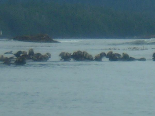
Sea otters are cute.
Sea Otter
Flash mob of sea otters.
Sea Otter
              nursery?
I liked the bonzai-tree looking growth on top of the sea stack at center image. Sea Otter
After night-long rain, we packed and departed Spring Island through clearing weather.
Sea Otter
Dave Peebles en route to Crowther Channel.
Misty Dave
Group headed for Crowther Channel.
Peaceful Pacific
              under clearing sky
Kayaks beached at camp on Spring Island.
Kayaks at Spring
              Island camp
Scenic view from Spring Island camp.
Mountains and
              clouds

Kayaks at Spring
              Island camp
I wanted a picture that would capture the motion of the sea as it flowed and ebbed in the tidal pools. I'm not sure it is possible.
Tide working on
              Spring Island

At Fair Harbour, we all worked together to get the boats unloaded, vehicles packed, and boats racked. We talked about trying to make the last ferry out of Nanaimo, but that seemed uncertain and would then deposit us in Twassen after midnight.  So, instead, we drove out to Zebalos where we set up camp. We made our way to the Lodge Pole Inn in "downtown" Zebalos. The influx of the six of us swelled the crowd in the bar to about ten people and overwhelmed the bar tender, who had to call in reinforcement. Cold beers and hot food were ordered and consumed. Good, but understandably pricy given the distance from suppliers.

In the morning we made a smooth exodus from Vancouver Island. We got to Nanaimo about 11:00, and the 12:45 ferry was already 94% sold out, according to the electronic signs. So, we were all glad we had not stopped for breakfast along the way. As we waited, I watched a tug towing a huge log-boom raft into a mill in Nanaimo. The previous day at Fair Harbour, we watched logs being dumped into a boom, so it was interesting to see a log boom at it's terminus. The ferry sailed on time. We had great weather and spent part of the crossing on the open, top deck watching the rugged mountains of coastal BC pass to the east, while we drew closer to the huge snow cap of Mount Baker visible to the south. Frank pointed out the dramatic difference in color of the water as we crossed into the silt plume of the Fraser River, which drains a huge area of BC and enters the Sound through the city of Vancouver. I was a little sad when the Ferry operator called us to our vehicles, because it meant our group would be splitting and going back to the "real" world. I was sad to say goodbye to them, but happy to have paddled with them and thankful for a week's worth of stellar paddling and camping memories.


Last Edited: 2/7/13

Return to Overview Page
Continue to Going East