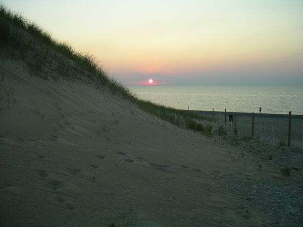
So the park preserves a natural place sandwiched along a developed Lake shore.
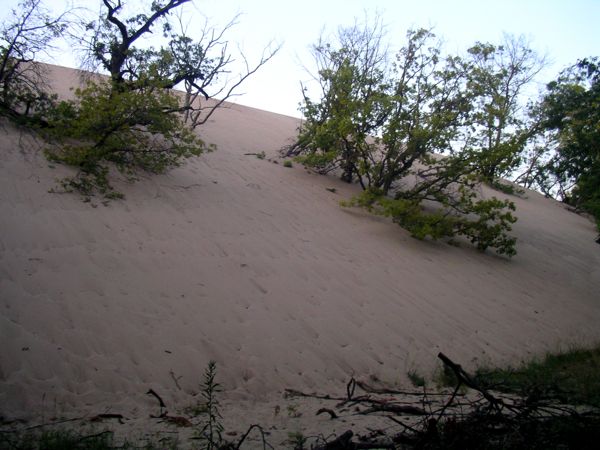
| On the inland side, the half
buried trees bear testament to the migration of Mt. Baldy. |
|
| Looking east from Mt. Baldy. |
|
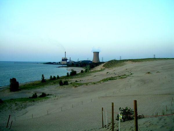
| The sun sets over the shoulder
of Mt. Baldy and Lake Michigan. If you go far enough to the
left, around the sand dune and a few miles down the beach,
there's a steel mill. So the park preserves a natural place sandwiched along a developed Lake shore. |
|
| The Mississippi in this area
runs between high bluffs that are separated by a mile or
more. In between the bluffs, there is a labrynth of
channels, islands, sloughs and marshes. There was a marked
canoe trail that ran 7 or 8 miles around Goose Island, and I
was afraid to deviate off this trail because everything
looked more or less the same and getting lost was a concern.
The signs turned out to be adequate but were far enough
apart that I wasn't always sure I was on course. There is a campground on Goose Island, and even though it was a Friday night, they had plenty of sites available. But for some reason, I wasn't ready to stay and went back into La Crosse. I stood in front of the coffee shop (now closed), was thankful they'd left the wi-fi on, and searched for vegetarian dining options. I decided to try the Root Note. They had vegetarian dishes, and were nice enough to veganize a special order for me. There was a band playing, but Root Note was nice enough to waive the $10 cover charge, since I just wanted food. The draft IPA tasted especially good after paddling in the near 100-degree weather. |
 |
| Badlands National Park as
viewed from near the park entrance. |
 |
| Rock formations like this are
common throughout Badlands National Park. This Park reminded
me of Bryce Canyoun NP, but less spectacular. The sandstone
formations have less definition than at Bryce, and the grey
and muted pink colors are sedate compared to the orange,
pink, and white at Bryce. |
 |
| It took a lot more than 30
minutes to get from I-90 to Mt. Rushmore. The town at the
base of the hill is very kitchie with lots of tourist
t-shirt and trinket booths. It made the Ocean City boardwalk
look upscale.There was a lot of traffic going to Rushmore
and I was crushed when my Golden Age Pass saved me nothing
on the $11 parking fee. There were hoards of people at Mt.
Rushmore, and it is kind of a curious attraction. But the
story of how it was funded and made is an interesting tale. The temperature at Rushmore was much cooler than down on I-90 and made me consider trying to find a camp site that was at altitude instead of returning to the sweaty lowlands. I looked up weather for the NPs in Wyoming and saw the highs were only in the 70s. That sounded good, but it was 2:00 already, and Wyoming was a long drive, so I looked for something local and decided to head for Wind Cave National Park. |
 |
| From Mt Rushmore to Wind Cave
National Park I drove through the Black Hills, which was an
amazing drive, the highlight of a day that took me into
three National Park/Monuments. I drove on a twisting Rt 16
as it ascended and plunged and actually cork-screwed over
itself as it wound up steep gorges (pigtail bridges--a new
term I learned). At places the road cuts through rock
outcroppings on the side of ridges. This road was built at
the urging of Governor and Senator Peter Norbeck and it
seemed like it was built just for the challenge of putting a
road where it seemed impossible to build. |
 |
| My route took me through Custer
State Park, where these buffalo where wandering around the
park. At Wind Cave NP, I told the camp host I wished I'd
stayed at Custer SP, because it was higher in elevation and
cooler. |
 |
| The buffalo roam where they
want, and if it is onto the road, a bit of a traffic jam
occurs. You have the locals who just want to get moving, and
the tourists who want to stop and take pictures. And you
have the buffalo, who are rather unfazed about the whole
thing and move out of the road when and if they feel like
it. |
 |
| I made it to Wind Cave National
Park by 6:00, in time to catch the last cave tour of the
day. Wind Cave is the 5th largest cave in the world and
contains 95% of the "open box" formations in the world
(image at right). The cave does not contain the dynamic and
dramatic stalactite and stalagmite formations of most caves
because it was formed from an underground lake, not running
water like formed most other caves. My Golden Age pass saved
half on camping fees and the cave tour fee, so the card had
already paid for itself in one day! One of the best part of the hour-long cave tour was the temperature in the cave, which was around 60. Wind Cave NP was around 4,000 ft elevation, much lower than Rushmore and Custer SP. Still, the overnight temperature got down into the 70s and I was able to sleep comfortably. |
 |
| On Monday, 16 July, I headed
west again. I stopped at Dale's Family Diner in Hot Springs
for breakfast and was served the best bowl of oatmeal, ever.
Incidentally, I saw four calendars there... it was a Least
Heat Moon kind of place. Then I drove out of the Black Hills and South Dakota, into grasslands, and into Wyoming. I was so impressed at how flat and featureless it was in eastern Wyoming that I snapped pictures out the window. |
 |
| The road was long, straight,
and mostly empty. I found the nothingness mesmerizing. The
truck was rolling along at 70, but it felt like I wasn't
going anywhere because the scenery stayed the same. After joining the I-25 at Orin Junction, the land takes on more form. Continuing west toward Jackson, the last 150 miles, there are mountain ranges in the distance both north and south. Gradually, the mountain ranges converge, the road runs alongside the Wind River, and there is a delight of visual interest. |
 |
| I reached Grand Teton NP
about 5:00 on 14 July. Fortunately, camp sites were
available. I'd hoped to get the boat on the water but
learned there was a whole process with attendant paperwork
needed to get on the water. There's a $10 permit, and a $15
self certification that your boat is free of invasive
species. Really you are supposed to wash your boat, and I
did spend an hour or more at the gas station with a hose,
soap, and vinegar (they tell you to use that), for whatever
it was worth. I also got a permit to hike to Surprise Lake from the Lupine Meadow trailhead for the following day. I set up camp in the Colden area, a huge campground that I think has over 200 camp sites. My ice was gone, and I didn't want more because I was back country camping the following night, so I had no choice but to drink the two Fat Tire beers in the cooler while they were still "luke cold." |
 |
| On 17 July, I slept a little
late, then began packing the backpack for an overnight hike.
I stopped by the shower/laundromat facility in Colden
village and grabbed a shower. The nice lady there comped me
the shower, normally priced at $3.75. I thought cold beer
would be good after my hike, so bought a block of ice and
more beer. Why do ice blocks hold much longer than
equivalent weight of ice cubes? With all the futzing, it
took me until noon to arrive at the trail head. The parking area at the trail head was completely full. I wedged the truck in front of some big vans with trailers that had parallel parked (everybody else was end-in). I hoped they'd be able to get out okay. I started the hike about 1p.m. |
 |
| I found the hike difficult.
It was almost all switchbacks and climbed 2,800' in 5 miles.
Worst of all, aerobically, I just couldn't keep up. As I
passed through 8,000' elevation, I could only go 50 to 75
steps between having to stop and let my oxygen-deprived body
catch up. So, it took me 5 hours to make the climb. On the way up, there were plenty of other hikers on the trail. But, after about 6 pm, there was nobody on the trails and I had the whole area to myself. I was a little worried about bears and made myself a little noise maker, putting pebbles in a plastic bottle and shaking it as I walked around. I didn't encounter any bears. In the morning the sky was clear, and at close to 10,000'', there's not that much air to hold haze, so everything seemed bright and clear. It was chilly. I walked around with my fleece and noise shaker. |
 |
| Surprise Lake was crystal
clear water and mirror smooth in the morning sun. |
 |
| When I came back down to the
car, which was mercifully more easy than walking up, I threw
gear in the truck and then went to find the boat launch onto
nearby Jenny Lake. I kayaked around the perimeter of the
Lake. |
 |
| I thought I was going to connect into Leigh Lake, but the connection seemed to be up a steep rapid and through some impassable wood piles. I abandoned the thought of continuing onto the other lakes. Instead, I beached the kayak on the far end of the lake and went for a swim, knocking off the sweat and trail dust of mountain hiking. | 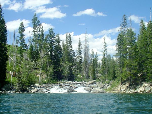 |
| View while kayaking Jenny
Lake. |
 |
| After kayaking, I went into
the town of Jackson and found a place for dinner. There were
surprisingly few bars in Jackson, which seemed to have
innumerable tour operators: hike, climb, raft, bike, ski,
and probably more. With all that adventuring, you'd think
there'd be a few bars to quench the thirst of all those
adventurers, but in my brief foray into Jackson, I saw none. I returned to Grand Teton NP and headed around to the north end of the park. The Lizard Creek campground where I tentatively planned to stay the night was full, so I continued north out of the park. The map showed campsites at Flagg Ranch, located on the John D Rockefeller Parkway that links Grand Teton to Yellowstone. I went there and got a site just before the office closed at 9:00. They put me right on the corner opposite the office, and then they hung a sign on the office directing late-comers to go back out and register at a nearby lodge. For two hours, I thought I was parked on a dusty interstate off ramp. RVs rumbled up, saw the sign, rumbled back out, registered, then rumbled back in. I was choking in dust. I went to the lodge and got my money back. Drove down the road a bit and bushwacked into the National Forest. I found a great spot to sleep, but the truck made inexplicable noises and I didn't sleep well knowing it was just me and the bears camped out there in the woods. |
 |
| Thermal Features Tour. I began at the Upper Geyser Basin, home of the famous Old Faithful geyser. I was not aware that Old Faithful is but one of dozens of geysers in the Upper Geyser Basin, and that there are a half dozen or more geyser basins. I auto-toured along the western side of Yellowstone's scenic loop, I kept looking for the iconic, colorful, springs flowing over layers of built up rock, and I kept not seeing these. I finally concluded they were at Mammoth Hot Springs, all the way up by the north entrance of the park. I drove up there, and I think that used to be where what I was looking for used to be. The water flow has decreased in recent years, so the scene I pictured may not presently exist. It was about 60 miles from Lewis Lake up the Mammoth Hot Springs. The speed limit in Yellowstone is 35 miles an hour, but due to the summer volume of slow-pokey tourists, actual driving speeds can be much less. The distance coupled with about ten stops, each with a walk-about, easily consumed the day. I returned to the Lewis Lake camp near dark. There were plenty of camp sites still open, so I hadn't really needed to come and get a site early, but who knew? I had a chance exchange with a neighboring camper, who asked if I'd heard an elk bugling. I asked if he meant a sound I was hearing at the moment. "Nah, that's coyote." Coyotes and elks, oh my, I wasn't in Gambrills. More pictures from thermal features tour. |
 |
| I interrupted my walk through
the Upper Geyser Basin to go into Yellowstone's Old Faithful
Inn, built from timbers by the CCC back when they did such
things. Two more pictures inside Old Faithful Inn. |
 |
| Friday morning, 20 July, I
prepped for paddling to Shoshone Lake. First, I reserved my campsite for the next two nights. It would be Saturday when I came off the Lakes trip, possibly late, and I expected a site might be hard to come by on a Saturday night in July. The launch was nearby. You'd think, from the truck, it'd be pretty quick to pack the kayak. But, it took me two hours to extract and pack the paddling subset of gear from the rest of the gear in the truck. I met some canoeists at the launch in a boat that had been creatively patched. Later on, they took my picture when I met up with them on Lewis Lake. I had a good trip to Shoshone Lake, returning on Saturday afternoon, 21 July. It was about 5pm by the time I returned to my camp site, and the campground did fill up, so I was glad to have booked the site, even though it cost me $6 for Friday night when I was out on the Lakes. The camp host told me somebody had set up on my site and that the host had to make them move, over their protests that "nobody's here!" I got some water and hand washed laundry. The low humidity in the west is remarkable. Even though it was late in the day, my laundered items were dry by the time it got dark. I slipped into the woods with a jug of water and gave myself a bath, too. Later that night some recent college grads asked if they could share my site. Since I was sleeping in the truck and had already packed everything up, I was basically only using the parking spot, so I said sure. Next thing I know, the five of them have built a fire and are sitting around drinking beers and yucking it up. So, I had to go join them for awhile, drink one of their beers, and explain that night time was for sleeping. They were pretty good about it, and I woke up later to hear them over around a fire at a neighboring site. That was much better than right outside my truck window. |
See TR for pics. Lewis Lake, Lewis River, and Shoshone Lake Trip Report. |
I departed Lewis Lake Campground at 6:30 on Sunday, 22 July, and made my way to Canyon Village, about 50 miles distant. I thought I would make an overnight backpack trip on the Yellowstone Canyon, to a place called Seven Mile Hole, but as I discussed this with the rangers at the Canyon Village information desk, it became evident the Canyon's best sights were serviced by road, and that the hike to Seven Mile Hole would be a lot of sweating and gasping for air for very little additional sight-seeing value. So, I opted for the auto tour. Image at right is Yellowstone Canyon viewed from Inspiration Point overlook along the North Rim Drive. More Yellowstone Canyon Pictures After auto-touring Yellowstone Canyon, I headed north, out of the park. Besides lots of tourists, on this day driving, I saw from the car Elk, fox, and a momma bear with three cubs. I drove out the north entrance into Gardiner, Montana. I was amazed at the number of foreign-speaking tourists in Yellowstone. I think over half the tourists in the park were not speaking English. I'm used to hearing Spanish, but in Yellowstone the languages tended to be other European languages. A little French, but mostly German, Scandanavian, and Slavic. I met two Australian guys who had been touring the country for seven weeks. My neighbor at the campground was Swiss climber who had been touring the country climbing mountains. |

|
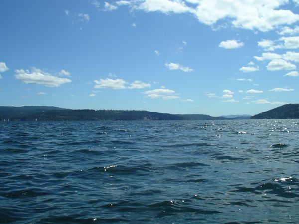
| There was a 20 - 25 mph wind blowing in off
the Lake. There were white caps and 1 - 2 foot waves outside
the breakwater. Lake Coeur D'Alene did not have the biggest
waves, but they really rocked the kayak in an odd way. I
felt like I was riding on the back of a drunken elephant. It
was almost as if somebody grabbed the back of the kayak and
was erratically rocking the boat. I paddled out past the
rocks and beaches along the town park and turned towards
where I thought the river entered the Lake. I paddled past a
beach resort with manicured grounds and rows of lounge
chairs neatly lined up along the beach. Oddly, there were no
people. I passed a second resort, larger than the first.
There was a large area of water that was cordoned off by a
floating breakwater. There was a golf course. But, again, no
people. I continued to paddle east until I came to an area
where a road runs right alongside the lake. There are docks
along the shore that I guessed belonged to houses up the
hill beyond the road. I stopped near the end of one of the
docks to roll the boat and cool off. Image right: looking south, down Lake Coeur D'Alene. |
 |
| Then I paddled back. Image right shows part
of the shoreline of the town park and the casino-marina
complex next to the town boat launch and parking area. |
 |
| This was a short but steep hike to an outcrop
that overlooked Puget Sound. The weather was perfect and we
hiked in our t-shirts, me sweating like a pig. Richard hikes
more quickly than I do and he had to wait for me a few
times. We sat on Oyster Rock and enjoyed the rewarding views
for a bit. There was a steady stream of day hikers coming
and going. There was an amazing amount of green on the trail to Chuckanut. If the ferns were any bigger I'd have thought I was in New Zealand. The trail crossed a dry stream bed. Richard pictured at image, right. |
 |
| Maybe because of driving across arid and
drought-stricken western states, the vegetation looked
insanely green. |
 |
| On Oyster Dome -- Richard and I pose at the
top of the Chuckanut hike. We were soon going and we walked down much more easily and quickly than we'd gone up. |
 |